

"Fosas Clandestinas": Method for predicting possible locations

Do clandestine graves (fosas clandestinas) follow any patterns? Researchers present a method for predicting possible locations
By Jorge Luis Cortés (IBERO)
October 14, 2026
Experts from the IBERO Human Rights Program and the University of Notre Dame presented a methodology in Geneva that uses open-source data and geospatial technologies to study the distribution of clandestine graves in Mexico and identify potential search areas.
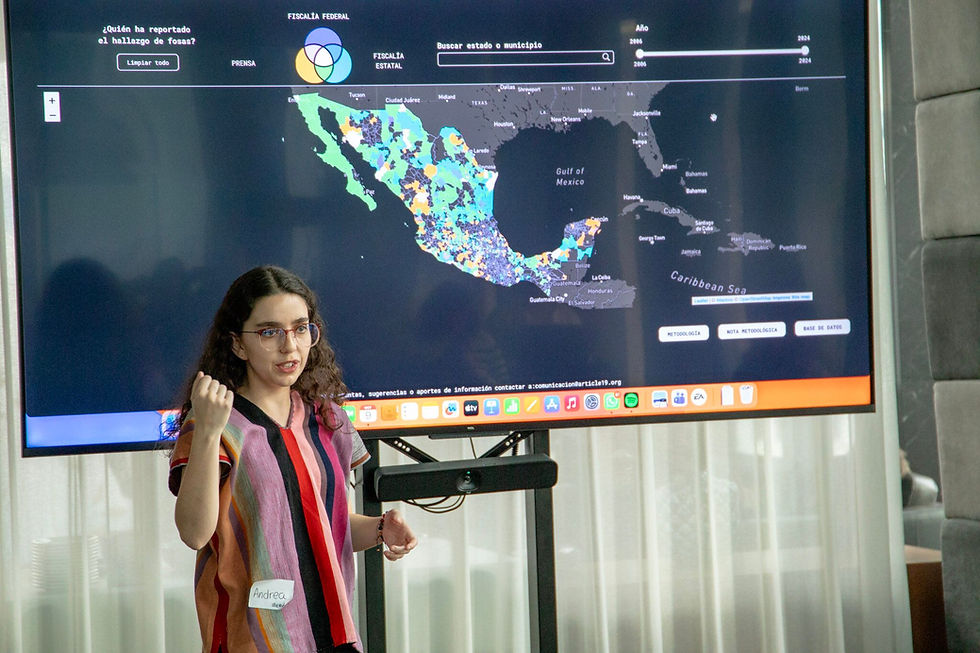
Is it possible to predict where a clandestine grave might be located by analyzing data, maps, and territorial patterns? This guiding question forms the basis of the work being carried out by the Human Rights Program (PDH) at the Universidad Iberoamericana in Mexico City, in collaboration with international academic institutions, to contribute to the search for missing persons in our country.
The research was presented at the Digital Investigations Summit 2026, an event organized by Amnesty International’s Digital Verification Corps (DVC) network, held on October 8 and 9 in Geneva, Switzerland, where specialists from around the world shared technological methodologies for documenting human rights violations.
Representing IBERO were Andrea Horcasitas Martínez, Coordinator of the Human Rights Program, and Leslie Salazar Jiménez, a researcher in the same program, along with Jorge Ruiz Reyes, a research associate at the Laboratory for Violence and Transitional Justice at the University of Notre Dame.
Their presentation, titled “Using Open-source and Geospatial Technologies to Locate Clandestine Graves in Mexico,” addressed a methodology aimed at understanding and predicting the spatial distribution of these clandestine burial sites.
How can technology help identify possible clandestine graves?
The project uses OSINT (Open Source Intelligence), a methodology that allows for the collection, verification, and analysis of publicly available information to conduct investigations.
Combined with geospatial tools, this information can be used to study the location of previously documented mass graves, identify patterns in their distribution, and delineate areas where new searches could be conducted.
The research presented in Geneva is based on a georeferenced database of clandestine graves covering five major metropolitan areas in northern, southern, and the Pacific regions of Mexico.
Its objective is to explain how graves are spatially distributed in urban environments and to develop approaches that allow for the prediction of possible locations based on the analysis of territorial information.
The proposal is based on a fundamental distinction: identifying areas with characteristics consistent with previous findings does not mean confirming the existence of a grave. The models seek to provide clues to guide investigations and optimize search efforts, which require subsequent on-site verification.
Clandestine graves are not necessarily distributed randomly
The research presented in Switzerland builds on a project developed by PDH IBERO, Data Cívica, Elementa DDHH, and CentroGeo, in collaboration with Amnesty International’s Evidence Lab.
In 2022, these institutions unveiled a geospatial analysis methodology applied to Baja California, the results of which made it possible to identify patterns of concentration of clandestine graves and delineate potential search areas.
An update published in November 2023 analyzed 160 georeferenced points corresponding to documented graves in Baja California. The results showed a statistically significant spatial concentration, suggesting that the clandestine burial sites studied had not been selected at random.
Furthermore, the analysis found that 144 of those 160 points were located in areas characterized by a combination of high accessibility and low visibility.
By integrating different layers of analysis, the team was able to reduce the area under consideration for potential searches by more than 80 percent, depending on the parameters used. However, the researchers clarified that the model did not allow them to pinpoint the exact location of a mass grave.
These findings illustrate how scientific tools can help identify territorial patterns related to clandestine burials, although their results should not be automatically extrapolated to all regions of the country.
The development of new research, such as that presented in Geneva, opens up the possibility of expanding the study of these phenomena to other geographic and urban contexts.
From university research to the search for missing persons
The potential of this methodology is not limited to academic analysis.
According to a publication by the research team at Amnesty International’s Evidence Lab in 2023, the results of the model developed in Baja California were shared with search brigades made up of relatives of missing persons.
During one of these search operations, the groups used geographic information provided by the project to guide their activities. The team documented two successful discoveries of clandestine graves during a search operation that relied on information derived from the model, although this does not imply that the system can automatically locate burial sites.
This collaboration serves as an example of how university research can generate useful tools for those directly involved in the search for missing persons.
It also highlights the importance of strengthening the links between scientific research, human rights organizations, families searching for their loved ones, and the institutions responsible for investigating disappearances.
IBERO shares its expertise with an international digital research network
The presentation took place during the annual meeting of the Digital Verification Corps, an international network affiliated with Amnesty International’s Evidence Lab, which celebrated its tenth anniversary in 2026.
This initiative brings together universities and experts who use digital tools and open-source information to document human rights violations and contribute to investigations related to justice and accountability.
Participating institutions include the University of California, Berkeley; the University of Cambridge; the University of Essex; the Universidad Iberoamericana; the Hertie School; the Geneva Academy of International Humanitarian Law and Human Rights; and Bard College Berlin.
The event featured lectures and workshops on digital verification, the documentation of war crimes, satellite image analysis, artificial intelligence, and new methodologies for investigating human rights violations.
The participation of Andrea Horcasitas, Leslie Salazar, and Jorge Ruiz made it possible to share their research experience on clandestine graves in Mexico with an international community dedicated to developing new tools for documenting and protecting human rights.
In a country where thousands of families continue to search for their loved ones, the possibility of using open data, spatial analysis, and scientific collaboration to identify potential search areas represents a line of research with significant social applications.
At IBERO, these efforts are part of a commitment to putting university knowledge and new technologies at the service of the search for truth, justice, and answers for the families of missing persons.
Originally published by IBERO.
This article has been adapted from the original in Spanish.
© 2026 Desinformémonos. All Rights Reserved.


